
description Atlas Mira (Soviet) Overview
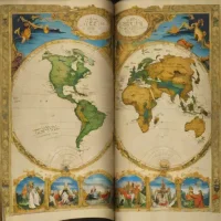
The Atlas Mira is a comprehensive world atlas produced by the Main Directorate of Geodesy and Cartography under the Council of Ministers of the USSR. First published in 1937, with subsequent editions like the highly detailed 1954 release, it served as the primary state-sponsored geographical reference for the Soviet Union. The atlas contains detailed physical and political maps of the world, emphasizing orographic, hydrographic, and climatic data. It was designed for use by government planners, academic institutions, and researchers, reflecting the advanced cartographic and printing capabilities of the Soviet state.
help Atlas Mira (Soviet) FAQ
Who produced the Soviet Atlas Mira?
It was produced by the Main Directorate of Geodesy and Cartography under the Council of Ministers of the USSR. It served as the primary state-sponsored comprehensive world atlas for the Soviet Union.
When was the Atlas Mira first published?
The atlas was first published in 1937. Subsequent editions, such as the highly detailed 1954 release, continued to update and refine its maps.
What is the Atlas Mira?
The Atlas Mira is a comprehensive world atlas. It was designed to be a highly detailed, state-sponsored geographic reference for the Soviet Union.
Were there updated editions of the Soviet Atlas Mira?
Yes, the atlas was continually updated after its initial 1937 release. The 1954 edition is particularly well-known for its high level of cartographic detail.
explore Explore More
Similar to Atlas Mira (Soviet)
compare_arrows Compare: Grosser Historischer Weltatl... See all arrow_forward


Reviews & Comments
Write a Review
Be the first to review
Share your thoughts with the community and help others make better decisions.


