
description Christopher Saxton Overview
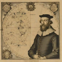
Christopher Saxton was a 16th-century English cartographer known for producing the first comprehensive atlas of England and Wales. Working between 1574 and 1579, he surveyed and engraved detailed county maps that set the standard for regional cartography in Britain. His work was supported by Queen Elizabeth I and her court, allowing him access to survey the country. The resulting atlas provided a foundational geographic record of Elizabethan England for administrators, navigators, and scholars.
help Christopher Saxton FAQ
What is Christopher Saxton famous for mapping?
Christopher Saxton was a 16th-century English cartographer famous for producing the first comprehensive atlas of England and Wales. This monumental surveying effort took place between 1574 and 1579.
Who sponsored Christopher Saxton's mapmaking project?
Saxton's extensive surveying and mapping project was heavily supported by Queen Elizabeth I's government. Official passes granted by the Queen allowed him to access restricted lands and command local authorities to assist him.
What technique did Christopher Saxton use to create his maps?
Saxton used the relatively new technique of copperplate engraving to print his highly detailed county maps. His maps featured intricate symbols for towns, hills, rivers, and windmills.
When was Christopher Saxton's atlas published?
The resulting collection of maps, titled *Atlas of the Counties of England and Wales*, was first published in 1579. It remained the standard geographic map of the region for over a century.
explore Explore More


Reviews & Comments
Write a Review
Be the first to review
Share your thoughts with the community and help others make better decisions.


