
description Fra Mauro Overview
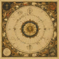
The Fra Mauro map is a meticulously detailed world map produced in approximately 1450 by Venetian monk Fra Mauro. This remarkable cartographic work represents one of the most advanced and accurate representations of the known world from the medieval period. Its significance lies in its sophisticated use of Ptolemaic projection, incorporating contemporary knowledge alongside older traditions. The map was created for the Studium Novum Nazarenorum, a monastic library in Venice, and remains valuable to historians, geographers, and scholars studying 15th-century cartography and global understanding.
help Fra Mauro FAQ
Where was the Fra Mauro map created?
The map was created in the Republic of Venice, specifically within the Camaldolese monastery of San Michele di Murano. Fra Mauro was a Venetian monk who gathered accounts from traveling merchants to chart the known world.
What makes the Fra Mauro map historically significant?
Created around 1450, it is considered the greatest medieval map of the world before the Age of Discovery. It provided incredibly detailed descriptions of Africa and Asia based on contemporary trade route knowledge.
Did Fra Mauro correctly map the southern tip of Africa?
Fra Mauro's map depicted a navigable route around the southern tip of Africa decades before Bartolomeu Dias successfully rounded the Cape of Good Hope in 1488. This bold assertion was based on rumors of prior voyages.
Who commissioned the Fra Mauro map?
King Afonso V of Portugal commissioned the original map, which was sent to Lisbon, though it has since been lost. Fra Mauro and his assistant later created a revised copy that remains preserved in the Biblioteca Nazionale Marciana in Venice.
explore Explore More


Reviews & Comments
Write a Review
Be the first to review
Share your thoughts with the community and help others make better decisions.


