
description Charles Booth Overview
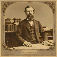
Charles Booth (1840–1916) was a British shipowner, social researcher, and reformer who produced detailed color-coded poverty maps of London in the late 19th century. His multi-volume study, "Life and Labour of the People in London," documented living conditions across the city's streets, classifying residents by income and social status. Booth's empirical surveys provided a foundational resource for sociologists, historians, and policymakers, fundamentally influencing early approaches to modern social administration and urban poverty analysis.
help Charles Booth FAQ
What do the colors on Charles Booth's poverty maps mean?
Booth's team colored individual London streets according to the apparent income and social class of their residents. Black marked the poorest category, while shades including blue, pink, red, and yellow represented progressively different social conditions.
How was the information for Charles Booth's London maps collected?
The first maps drew partly on reports from School Board visitors who knew local families and neighborhoods. For the later survey, investigators also accompanied Metropolitan Police officers on their beats and recorded street-by-street observations.
Which parts of London are covered by Booth's 1898-99 poverty maps?
The 12 published sheets extend roughly from Hammersmith to Greenwich and from Hampstead to Clapham. They use a detailed Stanford map of London as their geographic base.
Where can the original Charles Booth maps and notebooks be studied?
The Charles Booth archive is held by the London School of Economics Library. LSE's Charles Booth's London website provides digitized maps and police notebooks that can be explored street by street.
explore Explore More

Reviews & Comments
Write a Review
Be the first to review
Share your thoughts with the community and help others make better decisions.


